We use industry-leading scanners to ensure top-of-the-line quality and efficiency for any of the following situations:
Create training/site orientation virtual tours
Verify engineering design.
Building plot plan information modeling
As-Built Planning
Incident capture/reviews
Calculating volume based on topography
Virtual tour with asset management tagging
How it works
A
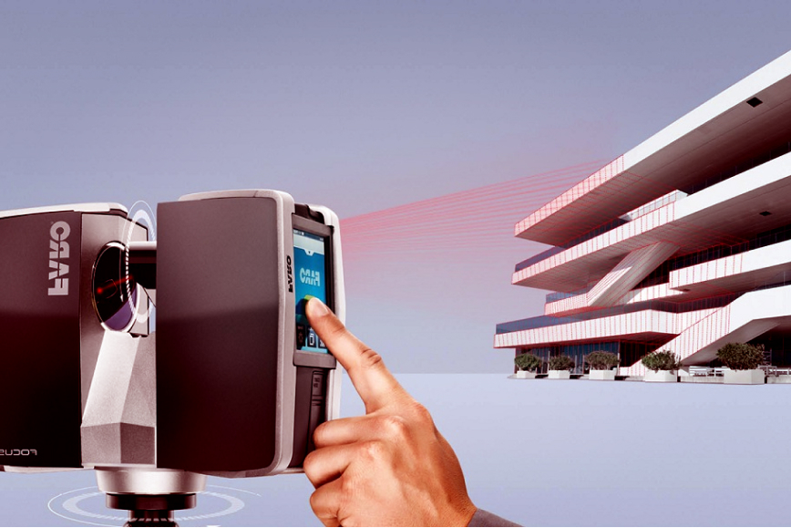
Camera Placement for Data Collection:
By placing one of our scanners in various positions around a job site, we’re able to collect millions of data points, creating a point cloud
B
Creation of Accurate 3D Models:
Referencing this point cloud, we are able to match dimensional information against your engineering drawings or create accurate 3D models.
C
Training your operations team
If you require a quick method to train your operations team or put together an early design, Redline can quickly capture your plant configuration using our state-of-the-art 3D cameras, returning a virtual tour complete with tagging.
Survey Services
Measurement is at the
heart of our survey
services
Topographical
Control Survey
Road and Bridge
construction progress scans
Deformation
Inspection
Settlement
Analysis
global spatial reference systems
Erosion
Monitoring
Calculating volume based on topography
Vegetation
Analysis
Mine/Quarry Surveys
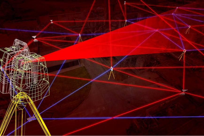
3D LiDAR Visual and Dimensional Capture
Photogrammetry by placing one of our scanners in various positions around a job site, we’re able to collect millions of data points, creating a point cloud
Laser scanning, high-definition surveying (HDS), or reality capture is a type of laser survey done to map an area to a high level of accuracy. Data collected from the method is known as “point cloud,” and creates a database of connecting points in a 3D coordinate system.
Tell us your requirements, and we will have a solution for you.
Need a virtual tour of your house or business?
We use our 3D cameras to create a virtual tour quickly. We then add tags and links to your critical information.
Want to lease your office space?
We can create a virtual tour showing the world why they should lease your space.
Do you require accurate dimensional data to
engineer and reduce field rework?
Let us scan your site with our Leica P-50 to remove any doubt about fit-up and reduce installation time
Need safety training for your site operations?
We can create a virtual tour with tags to indicate safety-sensitive components and remove the guess work.